
Backpacking Map & Trip Planner
The trip planner built for multi-night backpacking.
Draw your route, drop your camps, and Trailfold breaks the whole trip into days, with per-day miles, elevation, and hiking time between each campsite. Free 3D terrain, permit requirements at a glance, and plan it with your crew.
Powered by Open, Trusted Data



Every other app plans a hike. You're planning a trip.
A route is one line.
A trip is nights out.
AllTrails, Gaia, and CalTopo are great tools, but they all treat your route as one continuous push. None of them know where you're sleeping, so none can tell you your per-day miles, your elevation between camps, or how hard tomorrow actually is.
Trailfold starts from the trip, not the line. Mark your camps and it breaks everything down by day. Simple enough for your second trip, dialed enough for your fiftieth. And it won't cost you $80 a year.
Everything a multi-day trip needs. Nothing it doesn't.
Whether it's your second trip or your fiftieth, Trailfold does the parts that are tedious to do by hand, and stays out of your way for the rest.
Click, point, done.
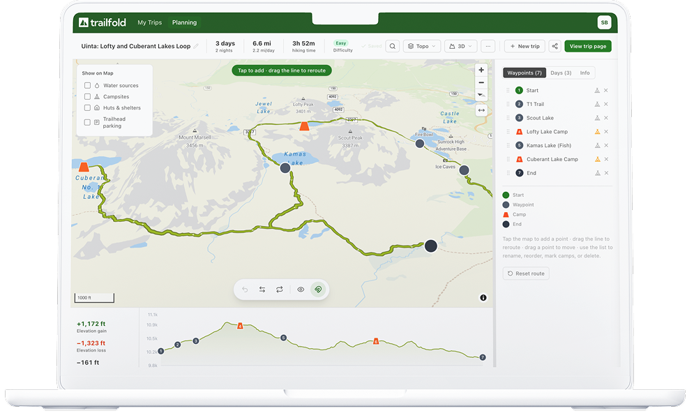
Tap the map to drop points and Trailfold snaps them to the trail. Go off-trail when you want. Drag the line to reroute, drag points to move them, reorder by dragging. It's fast and it feels good.
Mark where you'll sleep. We do the math.
No other planner does this. Drop a campsite and Trailfold splits the whole trip into days: per-day miles, elevation gain, and estimated hiking time between each camp. A "difficult 32-mile push" becomes a relaxed 4-day trip. See it before you commit to it.
See the mountains before you're on them.
Tilt into a 3D terrain view and understand the real shape of your route: the climbs, the passes, the exposure. Most apps charge for this. In Trailfold it's included, always.
Bring your crew, or the whole community.
Invite a friend to edit the plan with you. Share a view-only link for anyone to look. Or publish to the community, where other backpackers can copy your trip and make it their own starting point.
Share this trip
Invite to edit
Plan it together, in one place.
View-only link
Anyone with the link can look.
Share to community
Let others copy it for their own trips.
Permits, water, and closures, built in.
Trailfold pulls in permit requirements, active alerts and closures, and water sources from official sources for the park or wilderness your route enters. One less browser tab, one less surprise at the trailhead.
Works where you plan and where you hike.
Plan comfortably on a big screen, or on your phone from the trailhead. Import a GPX to start from an existing track, and export to load your route into Gaia, CalTopo, or your Garmin. Trailfold plans; your gear navigates.
Plan at home
Take it anywhere
GPX in / out
The planner is free. Forever.
Draw routes, mark camps, see per-day miles and elevation, plan with friends, and export your GPX. All free, no account tricks, no trial timer. You only pay when you want your maps offlinefor the backcountry.
Offline maps
One flat rate. No per-map math, no surprises.
- Everything in the planner: routes, camps, per-day stats
- Offline maps downloaded to your phone
- Plan with friends & export GPX
- 3D terrain and permit requirements
Only get out once or twice a year? Still worth it. That's a couple bucks a trip for maps that work where there's no signal.
The other apps, for comparison
The full-featured tiers run $50 to $100 a year, priced for people who live outside. Trailfold is built for the rest of us.
A few offer a cheaper entry tier, but it's usually mobile-only and strips out 3D terrain and the planning tools. With Trailfold, $20 gets you everything, on your phone and your laptop.
Ready for your next trip?
Create a free account and start planning in minutes.
Start Planning FreePowered by Open, Trusted Data
Trail data from OpenStreetMap. Elevation from SRTM. Permits, campgrounds, and closures from the U.S. National Park Service and Recreation.gov.